News
Temperatures After The Polar Vortex Could Be Way Different Than You Expected

There's some good news for midwesterners wondering when the 2019 polar vortex will finally end. According to the National Weather Service (NWS), the Plains and Great Lakes regions of the United States should see significantly warmer temperatures by the weekend. The predicted temperature fluctuations are vast, however, so expect some pretty drastic weather changes.
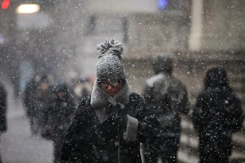
Millions of people from the Dakotas to New York, and as far south as Arkansas have experienced a gripping cold this week — even into the minus 50s Fahrenheit in some places, according to WDRB meteorologist Marc Weinberg. But by Friday, NWS predicts a swing in the complete opposite direction, with temperatures "well above zero" for the upper midwest.
"By Saturday, high temperatures will be in the 30s and even low 40s," the service reported on Thursday. "Additionally, the central Plains will see temperatures in the low 60s."
According to NPR, the well-below freezing polar vortex is due to system of frigid air that moved south from the Arctic and into the middle of the country. NWS chalks the dramatic shift up to that weather system now moving north into eastern Canada. Apart from being an about-face change of about 80 degrees, the service also reports that such unseasonably warm weather is 20-35 degrees above what they would expect for this time of year.
The unusual cold wave has been a serious hazard so far, accounting for at least 21 cold-related deaths. According to The New York Times, schools and businesses remained closed through Thursday and the increased heating needs across the region also caused power failures.
Massive flight delays have also been an issue, with The Times reporting more than 2,300 cancelled flights on Thursday. At Chicago's O'Hare International Airport alone, airlines cancelled more than 1,400 flights on Thursday, according to CNBC. Temperatures there have been in the negative 20s with a wind chill of nearly minus 40 degrees Fahrenheit, reported the outlet.
Along with this most recent cold spell came the president's repeated skepticism about climate change. "What the hell is going on with Global Waming? [sic]" Trump tweeted on Monday. "Please come back fast, we need you!" But in fact there is strong evidence to support the idea that this extreme weather is a manifestation of climate change.
The Times reported that the cold weather system could have been pushed down south by a jet stream caused by warm Arctic temperatures. Circling winds hold the icy polar air in place over one region, and those are what have caused the brutal cold of the last week.
"We have seen more of these [jet streams]; we've noticed that trend already, that's proven. And all of our climate models show this trend will continue," meteorologist Johanna Wagstaffe told CBC. "And that doesn't just mean more heat and more drought conditions. It can also mean more of these extreme cold blasts or extreme wet or snowy systems staying in place longer than normal."
The National Oceanic and Atmospheric Association (NOAA) supports Wagstaffe, reporting that extreme cold weather like this week's might end up being more common as climate change progresses.